
File:Qatar in Stielers Handatlas 1891 59.JPG

Size of this preview: 307 × 479 pixels.
| |
This is a file from the Wikimedia Commons. Information from its description page there is shown below.
Commons is a freely licensed media file repository. You can help. |
Summary
| Description |
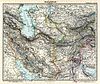
English: Qatar in "Iran and Turan Map by Adolf Stieler map 1891"
فارسی: کشور قطر در نقشه ایران و توران در دوره قاجاریه
|
|||||||||||||||||||||||
| Date | 1891 | |||||||||||||||||||||||
| Source |
|
|||||||||||||||||||||||
| Author |
|
|||||||||||||||||||||||
| This is a retouched picture, which means that it has been digitally altered from its original version. The original can be viewed here: Stielers_Handatlas_1891_59.jpg. Modifications made by Geagea.
|
Licensing
|
File usage
The following pages on Schools Wikipedia link to this image (list may be incomplete):
I want to learn more...
Through Schools Wikipedia, SOS Children's Villages has brought learning to children around the world. SOS Childrens Villages helps more than 2 million people across 133 countries around the world. If you'd like to help, learn how to sponsor a child.